|
|
||||
|
|
||||
 |
||||
|
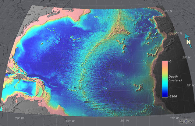
Global Global Mapping-What is the Shape of the Ocean Basins and Continents?
A sensor called a radar altimeter sensor is mounted on a satellite to detect the height of the sea surface. In oceanography, the height of the sea surface is directly related to the underlying seafloor topography. The radar altimeter accurately measures altitude by sending microwave energy towards the surface of the Earth. The travel time of this energy down to the Earth and back to the sensor is recorded, and converted to the height of the sensor above the surface. The height of the sea surface is compared to a reference point. These data are then converted to seafloor topography using a complex mathematical model. The final dataset is used to create a bathymetric map of the seafloor. The accuracy of these maps is 5-10 km for location and 100-250 m in depth. For specific areas of interest (such as Lost City), ground-truthing is required to verify bathymetric features of interest. This is typically done using sonar instruments on a ship. that create detailed, high resolution maps on a local scale. |
||||