

2003 Lost City NSF Expedition AT7-34
R/V Atlantis and D/S Alvin
19 full Alvin dives were completed within the Lost City Hydrothermal Field

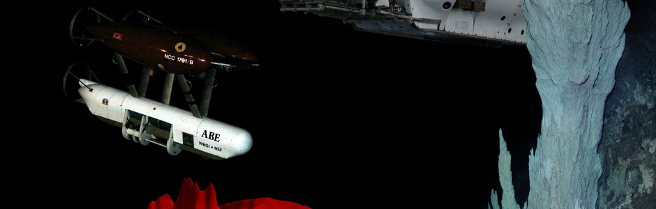
The autonomous benthic explorer "ABE" being recovered after a successful underwater miss ...
ABE Recovery

One of the first images of the massive Poseidon structure taken during the NSF-funded 2003 expedit ...
Summit of the 60-m tall Poseidon Edifice
This highly successful field program, funded by the National Science Foundation, was carried out on board the R/V Atlantis, April 21-May 22, 2003. During this expedition (April 21-May 22) 19 full Alvin dives were completed within the Lost City Hydrothermal Field, and over 220 hours of seafloor video imagery were collected. The autonomous vehicle ABE flew 17 missions, with a total bottom time of 127 hours that imaged nearly 200 km of seafloor. In concert, these surveys resulted in a remarkable, high-resolution bathymetric map (gridded at 2 m) of the field and prominent escarpment that characterizes the summit of the massif (Figure 1). The coupled, synergistic activities with ABE and follow-on Alvin dives allowed extremely detailed maps to be viewed that were updated daily. This resulted in very efficient use and guidance of Alvin on bottom and was a tremendous benefit to cruise planning. The web site URL is www.lostcity.washington.edu/index_old.html.
Because many of the questions we were addressing were highly interdisciplinary, where possible, carbonate, peridotite, and macro-microfaunal samples were collected with coregistered vent fluid samples. In concert, this sampling program allowed 10 individual sites to be well characterized within the field. Examination of the many benches that underlie the Lost City Field shows that many of the features that control fluid flow are very gently west-dipping faults. This nearly horizontal sheet-like style of flow is very different to the vertical conduits that typify black smoker environments and it will require rethinking of how fracture-controlled flow operates in such an environment. In addition to the focused suite of dives within the field, two exploration dives extended coverage along the escarpment to the east and west another two kilometers. The eastern dive delineated a nearly continuous zone of deformation at the top of the massif that is very likely the detachment fault zone sought in the previous MARVEL 2000 program.
The Lost City Field is an astounding, intensely beautiful area that hosts numerous composite chimneys that vent fluids at temperatures up to 90°C with pH’s up to 11.0 (Figure 2). Many structures contain an array of delicate flanges, multiple pinnacles, and beehive deposits. The structure Poseidon dominates the field: it is over 60 m in height, >40 m in length and it hosts multiple active and inactive towers, smaller pinnacles, and flanges. Perhaps the most spectacular part of the field, however, occurs on the western side of the Lost City promontory. For tens of meters, the escarpment at ~800 m and lower is encased in active and inactive carbonate deposits that exhibit a vast array of morphologies, which must rival some of the most beautiful cave deposits (Figure 2). The most striking structure in this area, however, is a snow white, 30 m tall, edifice (now called the Nature Pinnacle) that rises gracefully out of the serpentinite bedrock. This multi-pinnacled, slender structure is venting >60°C fluids from multiple orifices, and it is one of two chimneys from which live mussels were recovered.
This program was extremely lucky to have an impressive array of imaging equipment available, which resulted in outstanding, detailed documentation of the field. For example, the video frame-grabbing system yielded over twenty four thousand images that are coregistered with navigation and Doppler dive tracks, two three-mega-pixel digital still cameras collected over thirty five thousand images and, inside Alvin, the pilot and observers captured additional fifteen hundred digital images through the view ports. Stunning footage of this area documents massive carbonate towers, white “beehive” structures venting